Start from a satellite view of your actual yard
Type your address and trace your property line. Two minutes later you have a to-scale design of your yard with the house, the driveway, and the existing trees already on it — and you never touched a tape measure.
Plantyd is in closed beta. Ask for an invite — we send them as places open up.
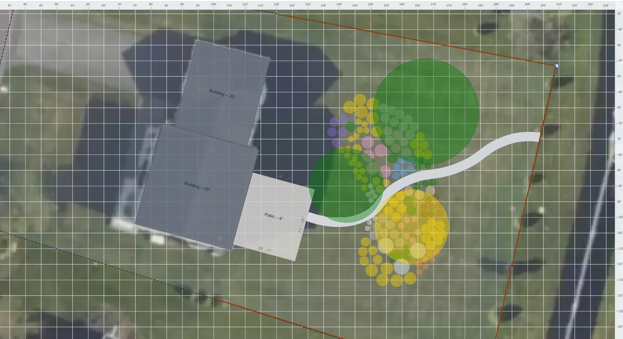
Why a photo beats an empty rectangle
Most garden design tools hand you a blank white box and ask for your dimensions. So you spend an evening with a tape measure, working out where the driveway meets the lawn. The drawing still comes out wrong — in ways you find at planting time.
Plantyd starts from the aerial photo of your property instead. Your house, your fence line, your neighbor's shade trees, the awkward corner where the garage juts out — they are already there, at the right size, in the right place.
That matters most when you buy plants. A shrub sold as “6 ft spread” either fits the space you have or it doesn't. Now, you can see that on screen, before you pay for it.
Trace your property once, and every design reuses it
Setting up a new project takes about two minutes. Plantyd reads the scale from the map's coordinates, so a foot on screen is a foot on the ground — you never type a dimension.
- Type your address. The map moves to your property.
- Click each corner of your lot to trace the property line. Double-click the first corner to close the shape.
- Trace the things that already exist — house, driveway, patio, shed — straight off the photo.
- Hide the photo when you are done, and work on a clean design.
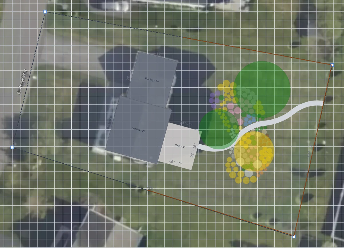 Photo on, while you trace
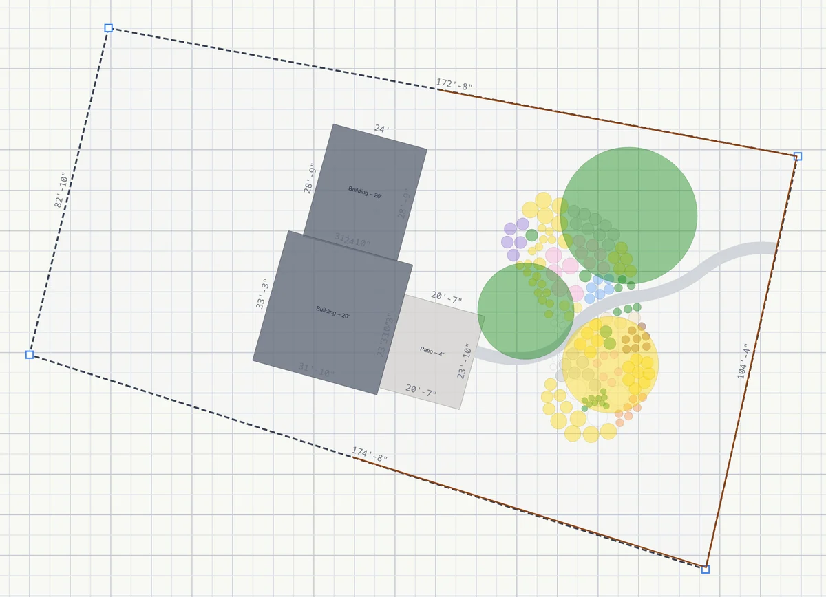 Photo hidden, to design
Everything you draw is measured
Because the design knows its own scale, so does everything you add to it. A patio you trace reports its real dimensions on the drawing. The Measure tool gives you the distance between any two points in feet and inches — the gap between the house and the fence, the width of a bed, how far apart two trees will sit.
Your address does three jobs, and then it is done
Plantyd uses it to find the aerial photo of your property. It uses your latitude to work out where the sun sits in your sky through the year, which is what the sun analysis is built on. And it uses the frost dates at your nearest weather station to date the sowings and harvests in the bed planner. Nothing else needs it.
The satellite image is a starting reference, not a permanent background. Exported plans and PDFs use the clean version, because that is what a contractor or a nursery wants to read.
See this on your own yard
Request an inviteLeave your email and we’ll send your invite as places open up. We only email about your invite and the occasional update.
The rest of the picture
Know exactly where every shadow falls
Plants fail in the wrong light more often than for any other reason. Plantyd counts the hours of direct sun that reach every square foot of your yard, then shows you the species that will work best.
See how sun & shade analysis works →Bed plannerPlan your vegetable beds week by week
Lay crops out on a square-foot grid, and Plantyd builds a calendar from your own frost dates: when to sow, when the bed frees up, and what can still finish before the cold.
See how bed planner works →Growth over timeWatch your garden mature before you plant a thing
Move one slider and your whole design grows. See it at Year 1, Year 5 and Year 15, so you can fix the spacing now — while fixing it is free.
See how growth over time works →